Resilience
A pioneer in hazard mitigation and adaptation planning for the Bay Area, ABAG’s Resilience Program assists Bay Area local governments and residents in planning for earthquakes, the effects of climate change and other hazards. We support recovery and hazard mitigation with robust, curated tools for research, planning, policy, implementation and funding for resilience initiatives. These pages take an action-oriented approach toward assisting local communities with resilience planning and implementation.
Historic Leaders in Resilience Planning
Resilience is a community’s ability to withstand and rebound from a profound shock. In the Bay Area, where regional hazards range from earthquake shaking and fault rupture to extreme heat and sea level rise, resilience planning is critical to our ability to withstand, sustain and rebuild, preserving the unique cultural and economic character of our communities. Resilience planning can help us bounce back stronger.
In the 1970s, ABAG created the Earthquake and Hazards Program with the mandate of leveraging the best available science to characterize the natural hazard risks for the Bay Area. After the 1989 Loma Prieta Earthquake, the Earthquake and Hazards program became a nexus of coordination for hazard mitigation and disaster recovery planning, providing new research for the nine counties and 101 Bay Area cities that share common risks from earthquake, flood, wildfire and other regional hazards. Though resilience planning is a growing concern across the state and the country, to date, the Resilience Program has no counterpart in any other metropolitan organization or in any other council of governments in California.
Resources for Regional Hazards and a Changing Climate
In 2014, the Earthquake and Hazards program became the Resilience Program to recognize the growing threat from climate impacts and the broader need to incorporate issues of affordable housing, social equity and economic vibrancy in resilience planning.
Our objectives are to:
- Develop a regional land use pattern which reduces the risk of natural hazards;
- Provide a platform for local governments to come together to jointly plan, share best practices and develop a shared understanding of regional needs to effectively mitigate and manage risk;
- Disseminate scientific information about natural hazards in an understandable and usable way that facilitates good policy and planning decisions;
- Provide specific tools for local governments to develop and implement hazard mitigation and climate adaptation recovery plans.
We carry out these activities through cross-jurisdictional coordination and collaboration, research, advocacy, education, communication, and technical assistance to local governments.
Over the past 20 years, the program has been a resource for local governments working on Local Hazard Mitigation Plans and General Plan Safety Elements. It is a growing resource for communities working in climate adaptation and resilience initiatives.
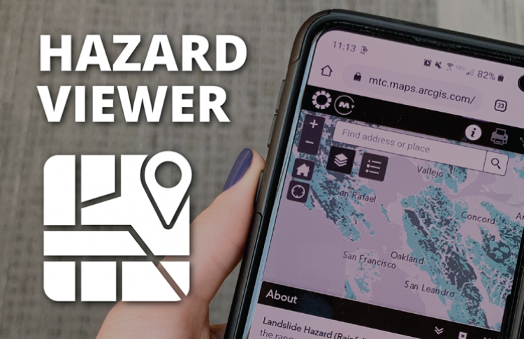
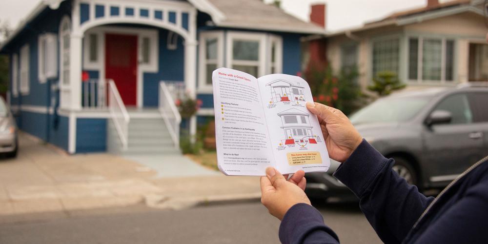
To that end, the Resilience Program has historically created and curated best-in-class and first-in-class resources for regional hazards. We created the first earthquake shaking scenario maps for the region and produced the first standard plan set for the retrofit of homes with a crawlspace. Our Hazard Viewer, for example, is a one-of-its-kind interactive map of regional hazards, curated from the most relevant, current maps for the nine-county Bay Area, an easy-to-use-tool for contextualizing local risk at the household-, neighborhood-, jurisdiction- and county-level.
On the following pages, we curate data, policy, planning, funding and implementation tools and resources for Bay Area jurisdictions to build strong resilience initiatives for their communities.
Partnerships & Processes
Our unique resources have grown out of partnerships with individual Bay Area cities and ongoing partnerships with state and federal agencies. We continue to partner closely with FEMA, BCDC and the USGS to provide resources and guidance specific to the 101 Bay Area cities we serve. We also translate state and federal resources into guidance specific for Bay Area jurisdictions.
In these pages, we lay out an action-oriented approach meant to carry users through the process of resilience planning from Data through Implementation, including:
Some users may have certain elements in place — e.g. Planning and Policy — and want to jump straight to later stages — e.g. Funding. Other users will find the entire Resilience Program section of the ABAG website useful as a step-by-step framework for the process of approaching resilience.
The work of resilience never ends. As risks evolve, new priorities emerge. The Resilience Program is a space for the 101 cities of the Bay Area to collaborate and set priorities for the challenges ahead. We hope you will find it helpful.
Plan Bay Area
Plan Bay Area is the regional long-range plan charting the course for the future of the nine-county San Francisco Bay Area. It pinpoints policies and investments necessary to advance the vision of a more affordable, connected, diverse, healthy and vibrant Bay Area for all, identifying a path forward for future investments as well as the types of public policies necessary to realize a future growth pattern for housing and jobs.
Launched in 2013, the plan is updated every four years. The current iteration of the plan — Plan Bay Area 2050 — was adopted jointly by the ABAG Executive Board and the Metropolitan Transportation Commission in October 2021.
The heart of Plan Bay Area 2050 is 35 strategies across the four key elements of housing, the economy, transportation and the environment. These strategies are public policies or investments that can be implemented in the Bay Area at the city, county, regional or state level. Equity is interwoven into each strategy and were crafted to be resilient to future uncertainties. You can access the plan document and its related supplemental reports on the Plan Bay Area website.
Work has begun on the limited and focused update, called Plan Bay Area 2050+. Visit the PlanBayArea.org website to learn more.
Upcoming Bay Area Resilience Planning
This comprehensive resource illustrates the known status of local Hazard Mitigation plans in the nine-county Bay Area, indicating when the plan needs to be updated for each jurisdiction. It is helpful for considering how LHMP updates coordinate with other planning efforts. Communities updating local hazard mitigation plans (LHMP) may also find it helpful to know which local communities are also doing this work at the same time.
This map also shows which towns and cities are subject to SB 1241, which applies to communities with very high fire hazard severity and unincorporated communities in state responsibility areas. For more information about communities affected by SB 1241, consult the CalFire Fire Hazard Severity Zones maps.
Regional Resilience Toolkit - 5 Steps to Build Large Scale Resilience to Natural Disasters
The goal of this Toolkit is to help cities, regions and other partners integrate various planning processes – including for hazard mitigation, climate adaptation, sustainability and equity – into a single process to create a common action plan. This Regional Resilience Toolkit can be used by regional partnerships and local jurisdictions just starting to plan for resilience, or by those ready to move from planning to action. It is a useful guide for any planning effort that incorporates resilience planning.
Soft Story Retrofit Program Development
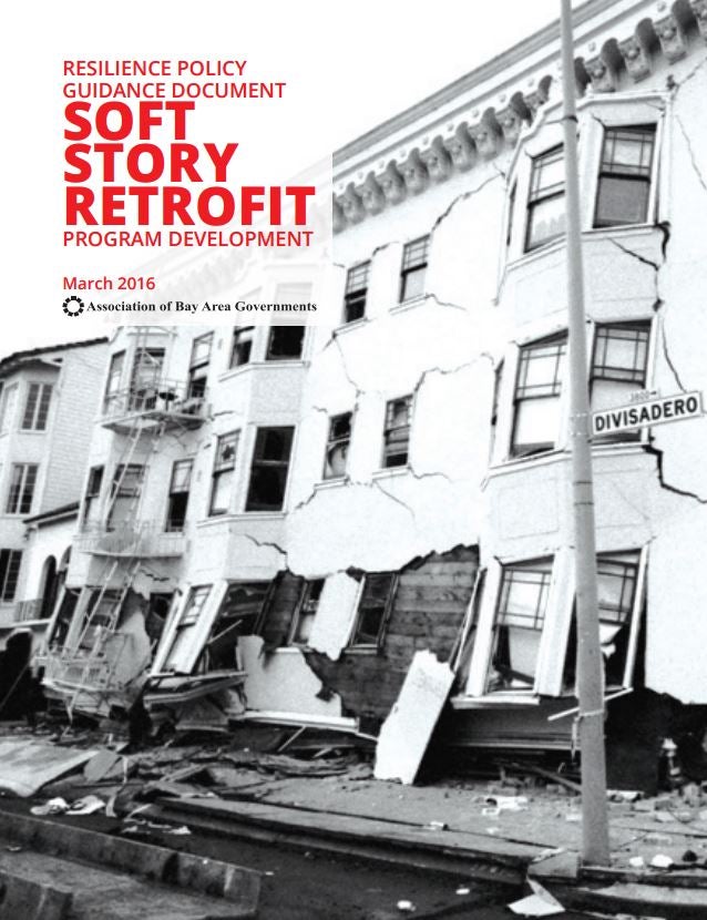
This guide provides information gathered from local experience and recommended practices for how to understand the problem that seismically deficient, multi-family “soft story” buildings pose for jurisdictions and the region, and how to develop a proactive retrofit program to reduce their earthquake risks. While the information presented here is based on extensive earthquake engineering knowledge, this guide is intended to be used by a non-technical audience, including jurisdiction staff and elected officials, to help guide policy development, adoption and implementation of retrofit for this common, fragile housing type.
Resilience Needs and Revenue Assessment
A first-of-its-kind of analysis of the amount of money the Bay Area needs to address our seismic risks in housing and to adapt segments of shoreline to the first three feet of sea level rise.
Beginning with an analysis of the different vulnerabilities throughout the region, the Resilience Program identified different mitigation and adaptation strategies to address those vulnerabilities in order to come up with a high-level estimate of costs to adapt the shoreline to sea level rise and to retrofit commonly deficient housing types to withstand earthquake shaking. Highlights include:
- $17.4B for sea level rise adaptation
- 150 of miles of shoreline adaptation and 100,00 acres of wetland restoration
- $6B for housing-related seismic hazard mitigation
- 385,000 seismically retrofitted housing units